…wild lunch in Akil Yucatan…
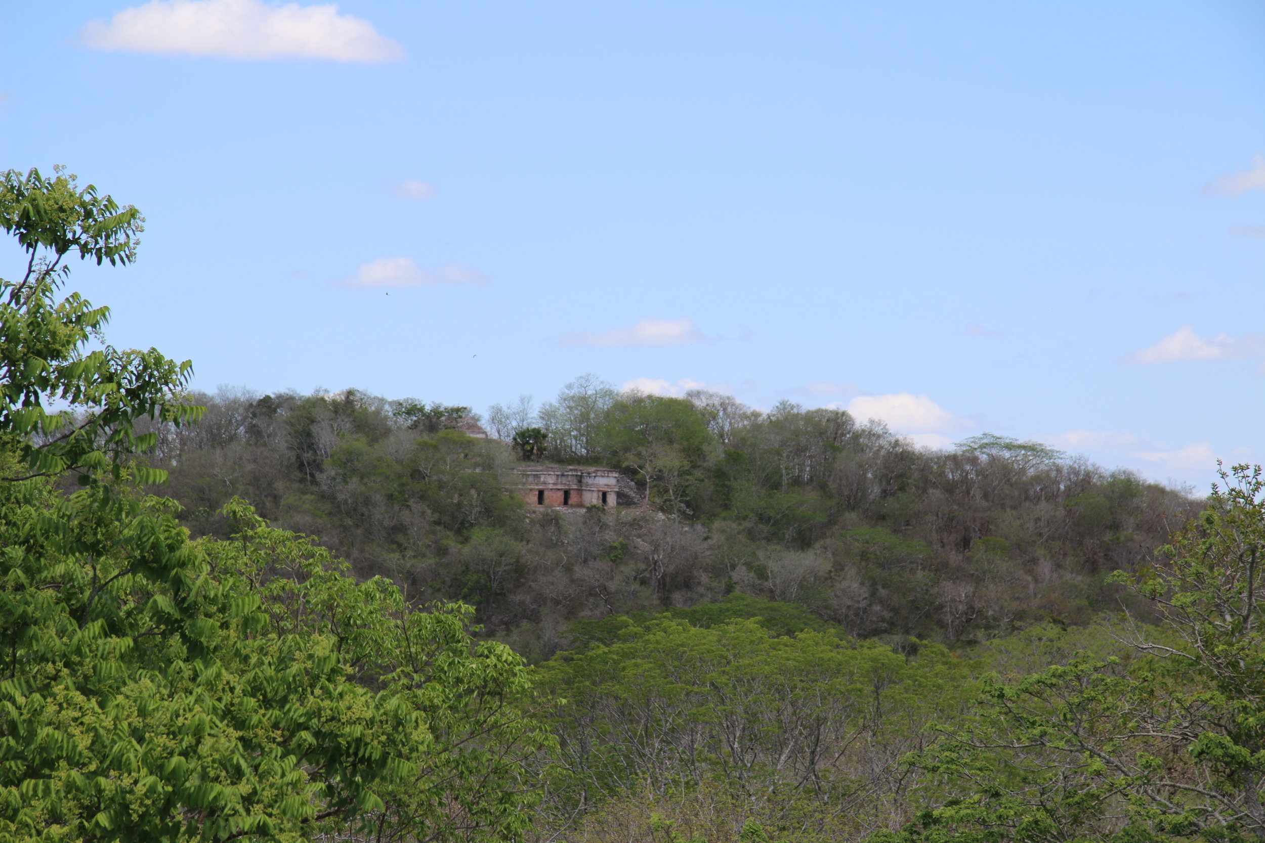
At the southern end of the Puuc route, which begins in Uxmal and extends through Kabah, Labna, Sayil and other less-known and some completely unrestored settlements still hiding in the jungle, there sits Chacmultun. Chacmultun means hill of red rock, which is the original name its discoverers gave it as the stone quarries in the region produce red limestone, as opposed to the whiter version in the northern part of the Yucatan peninsula. In fact, many Mayan sites are known by names that probably have nothing to do with their original names; given that there is no text to consult, no stellae to interpret, no record at all. That big hill in Coba? We’ll just call it Nohoch Mul. Big Hill. OK.
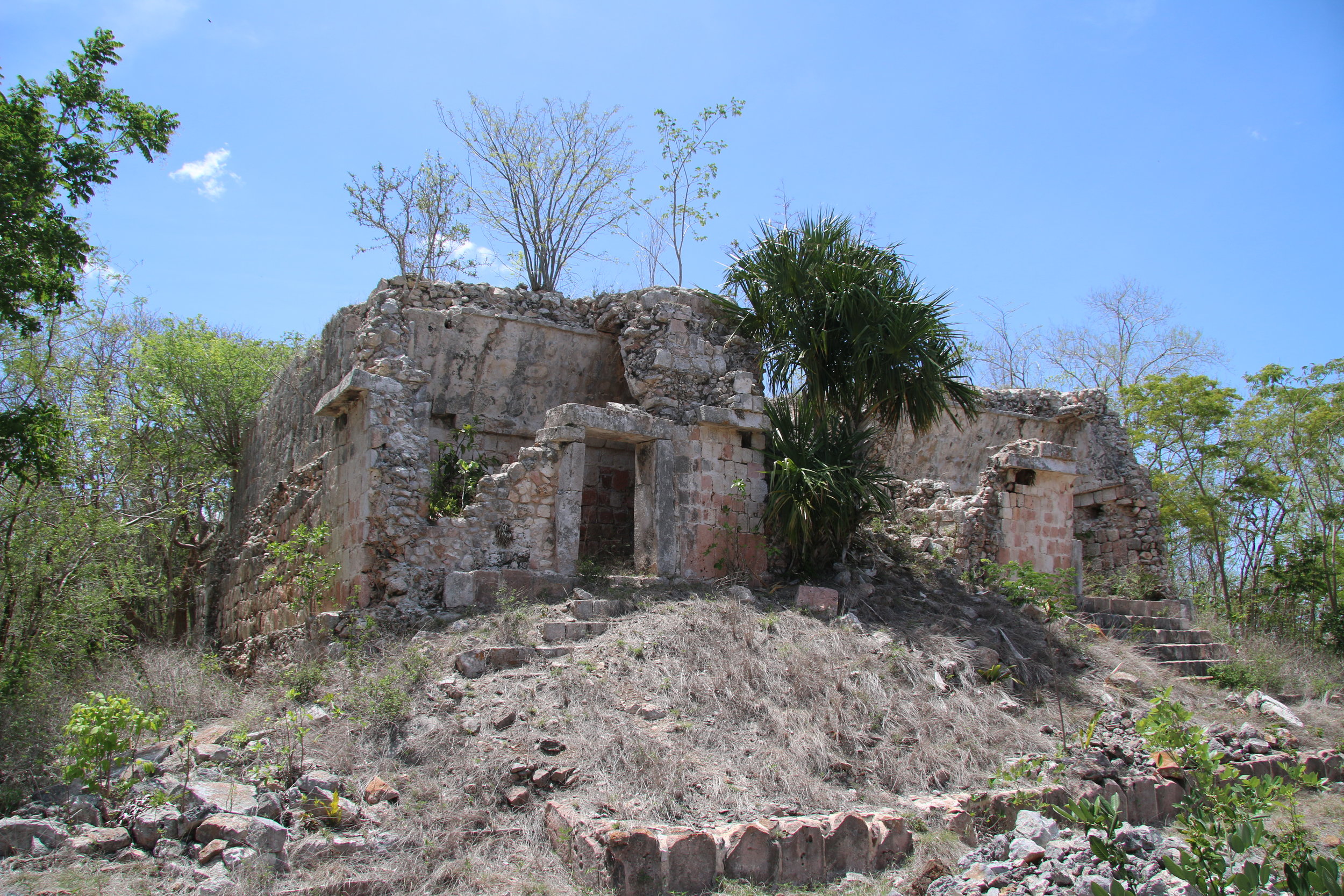
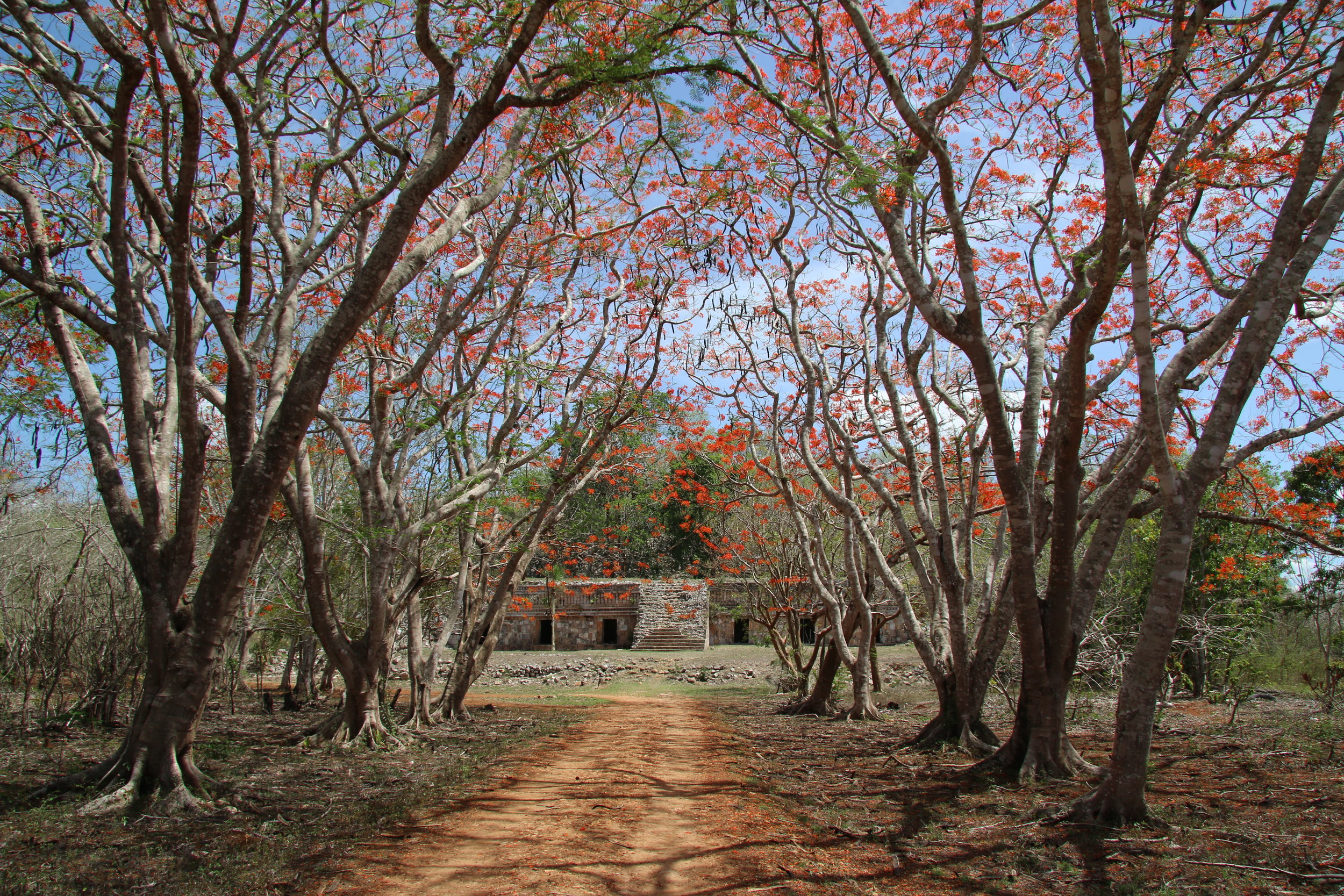
Back to Chacmultun. This site is a collection of three or four settlements, with Puuc-style temples and mounds, clustered around a small, fertile valley filled with rich red earth which would have been the agricultural production center at the time (it still is used for farming now).
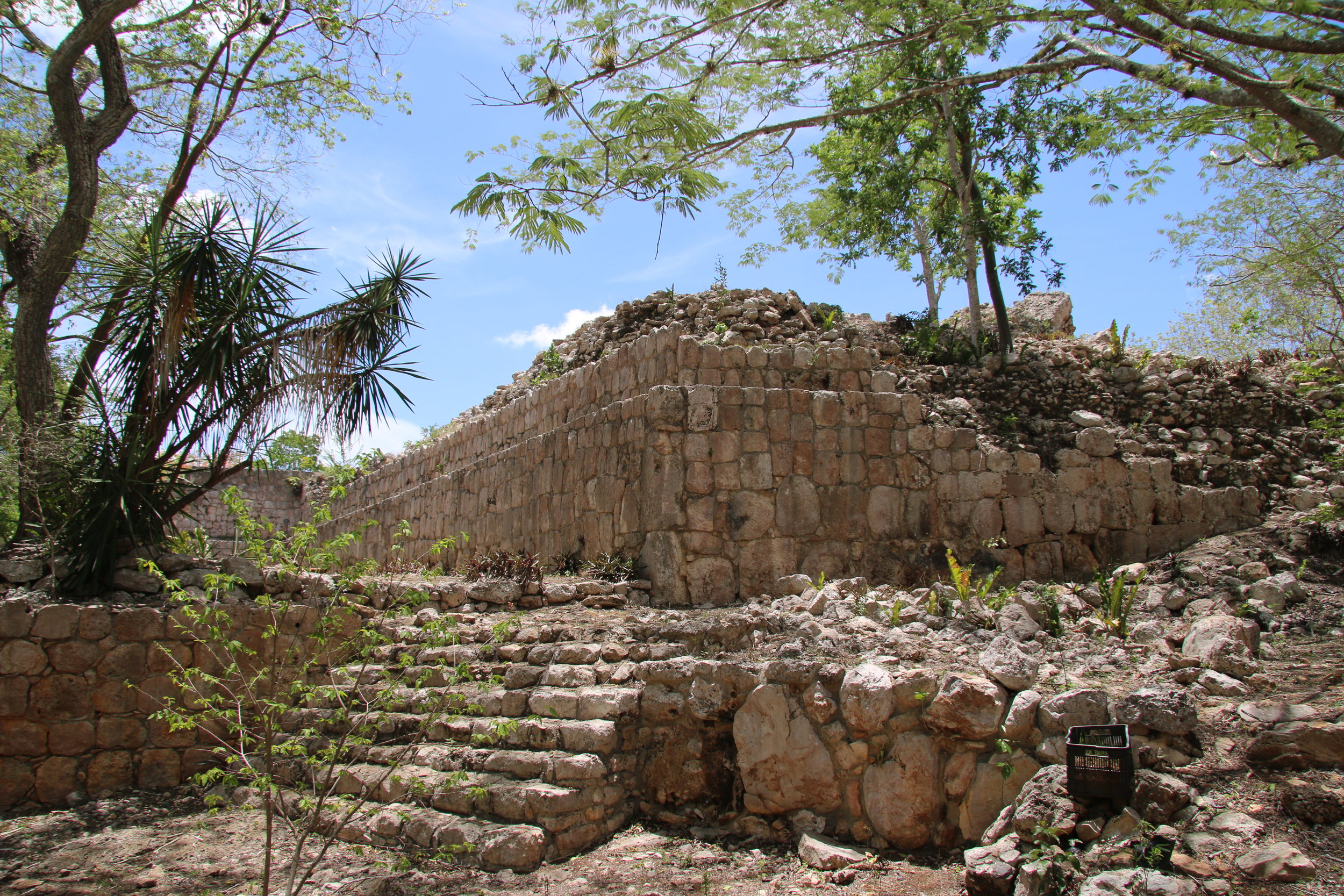
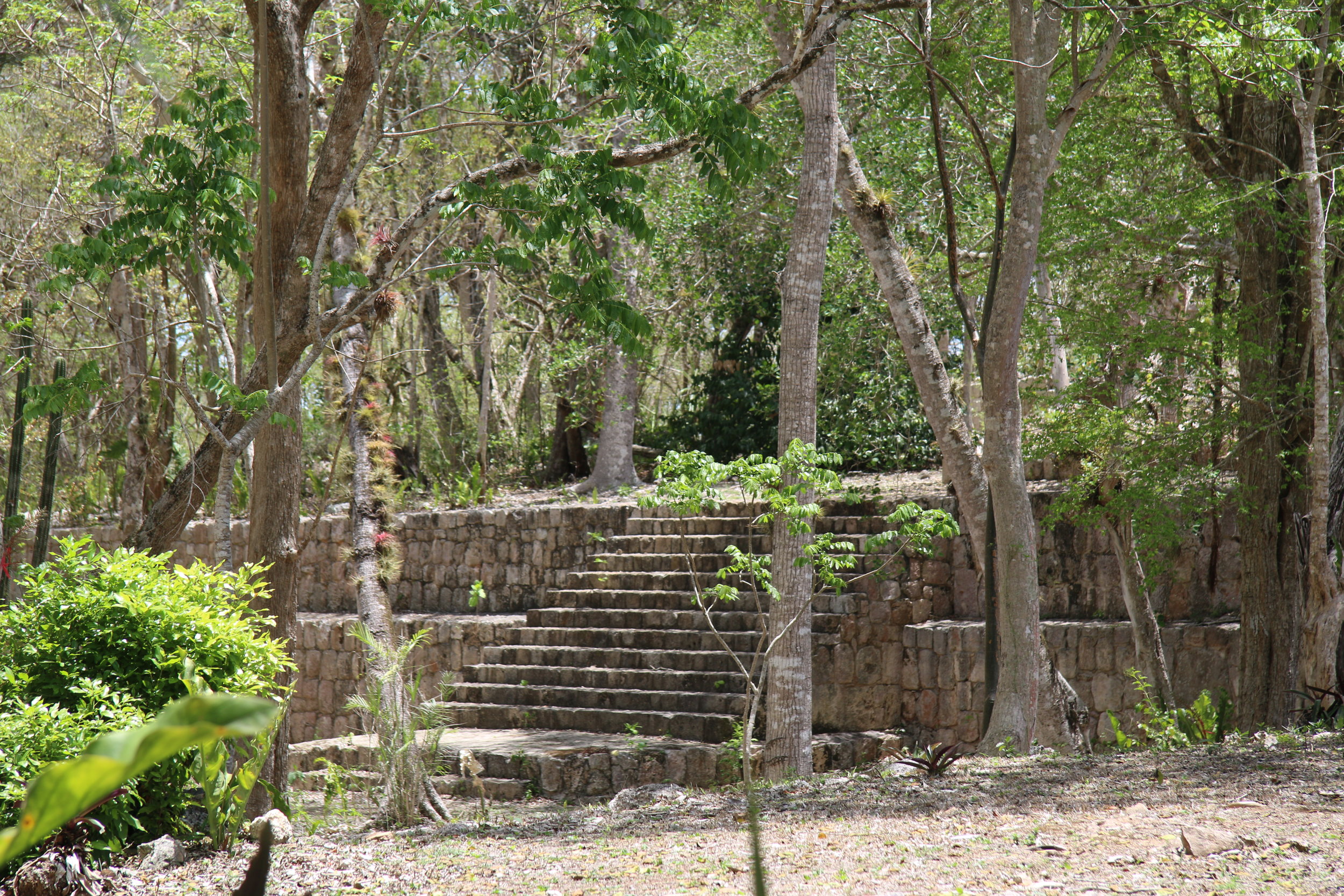
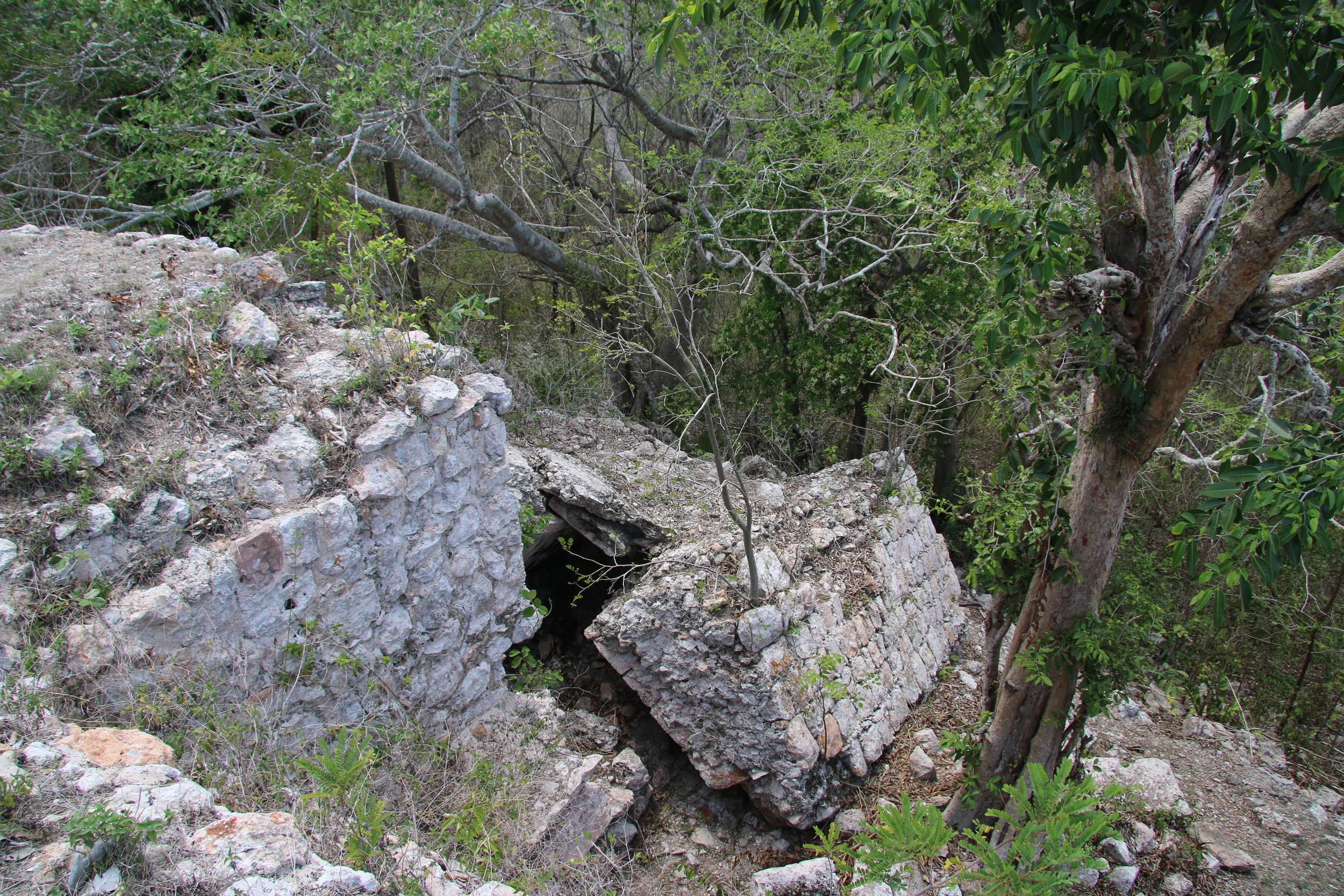
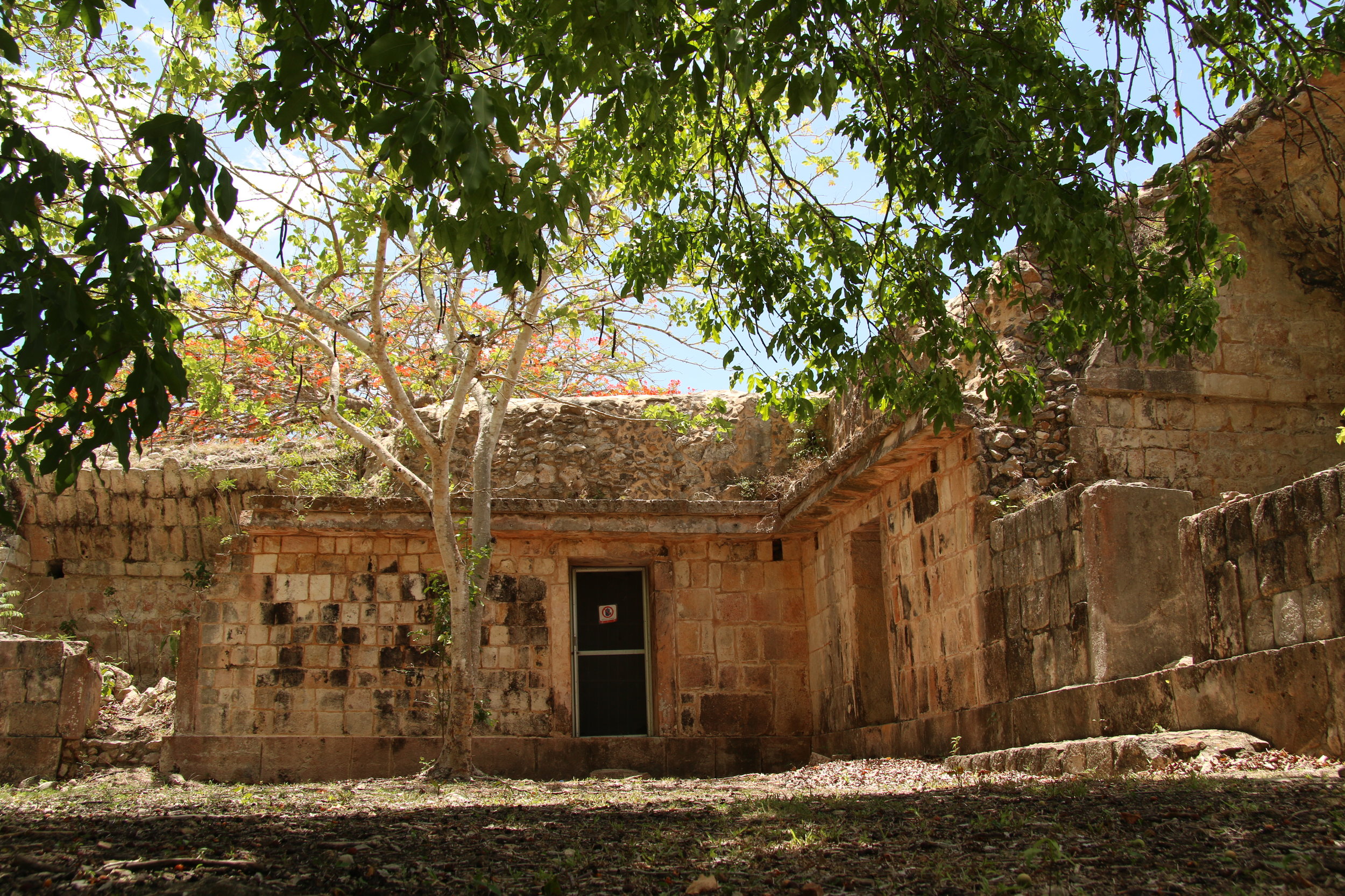
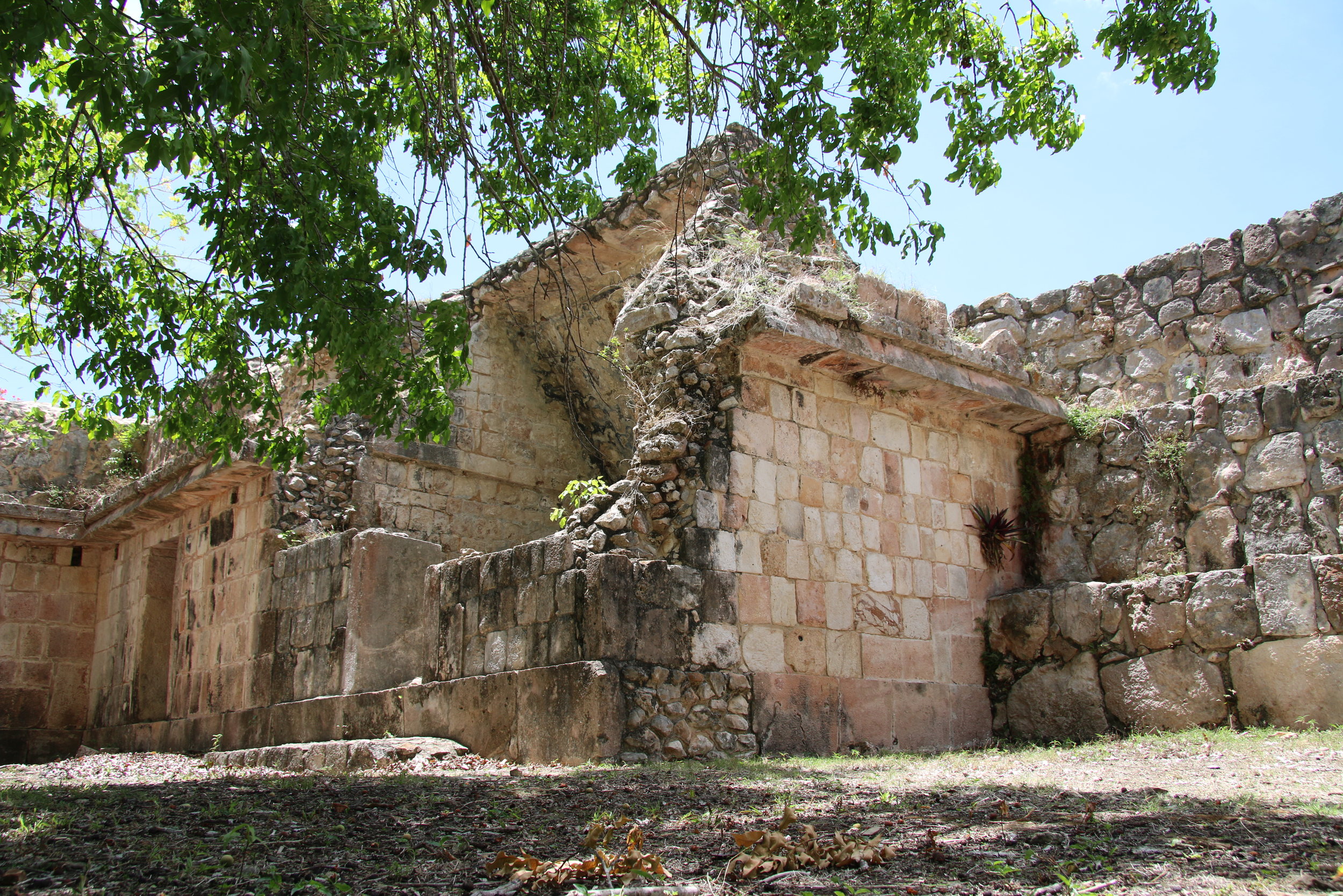
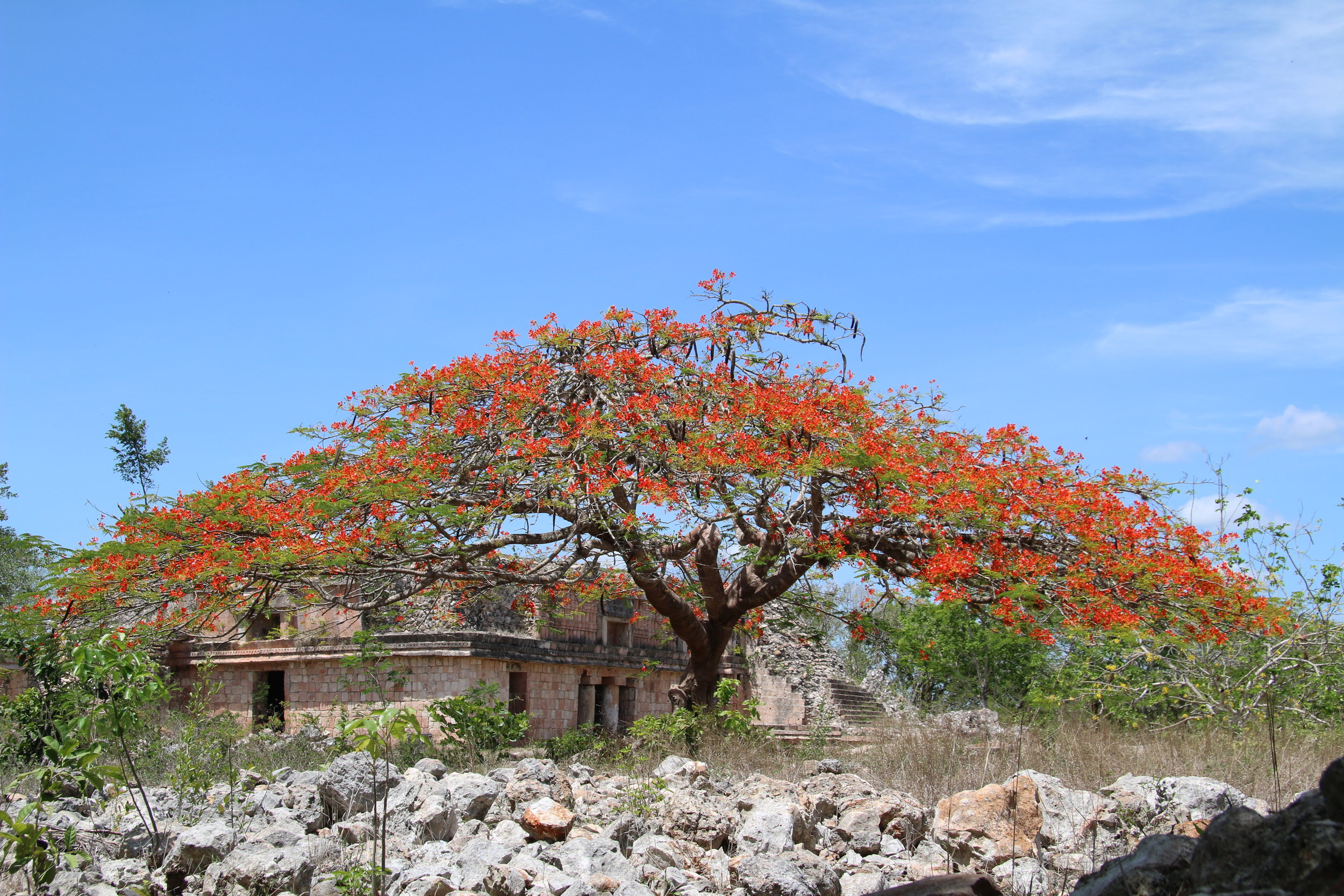
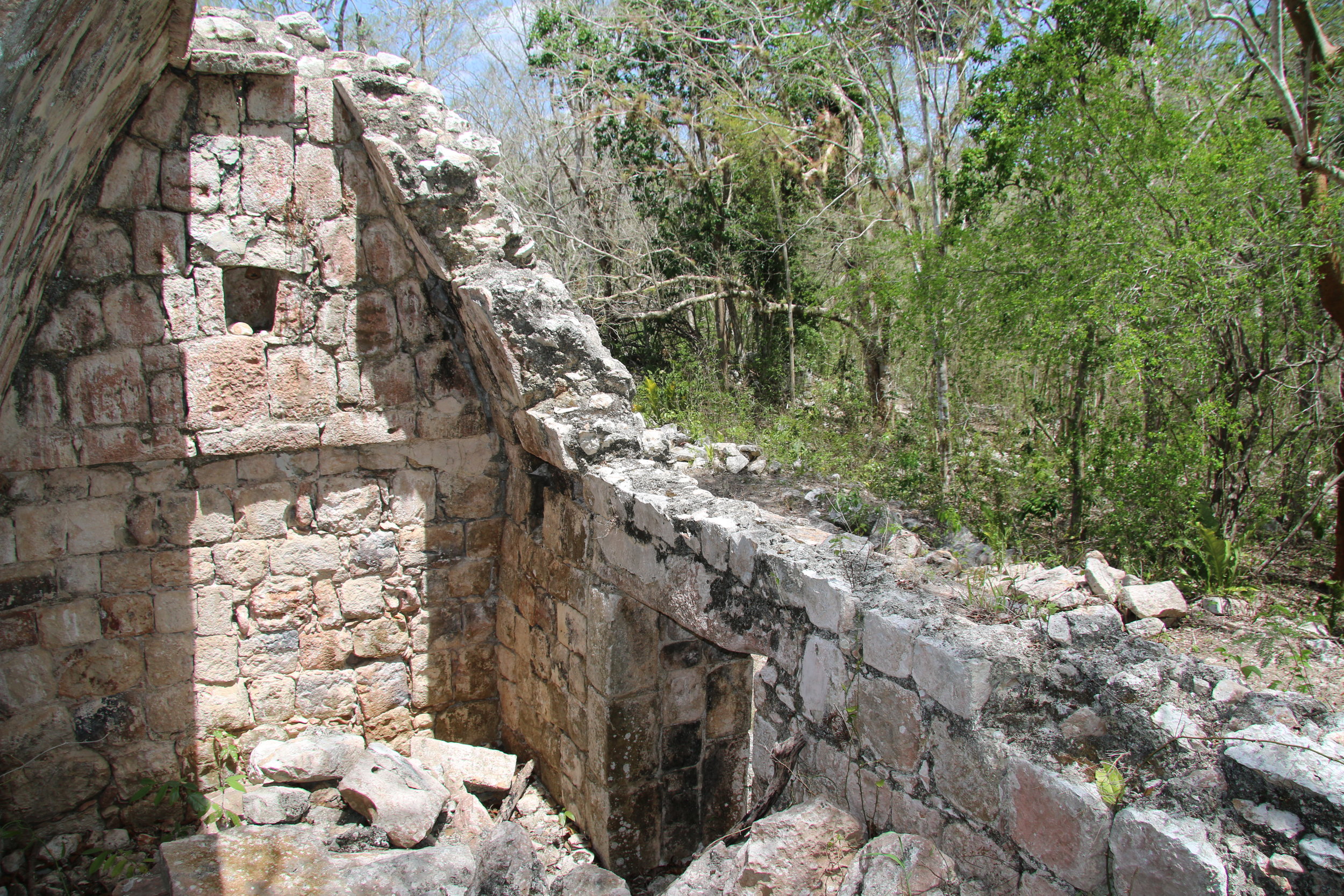
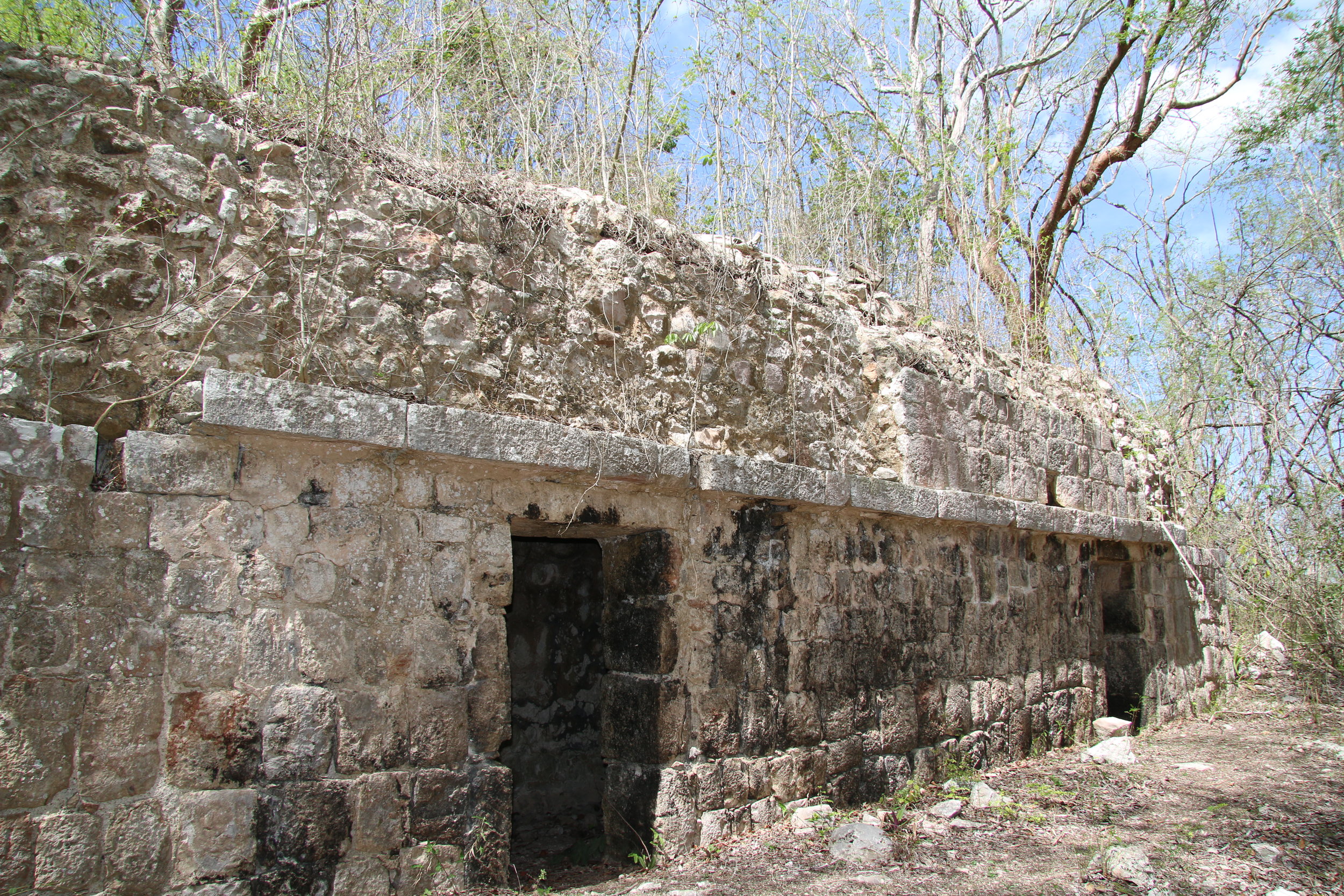
You will see partially restored buildings complete with friezes, cornices and decorative elements, some of which are cracked, others still intact. You can visit and clamber around most of the site, and will notice some very lame efforts by the INAH to “preserve” some of what is there. Some of the restoration is also quite miserable, the chultun in the main part of Chacmultun proper being a prime example (see photo). In one of the buildings there are paintings on the wall and to preserve them the specialists at INAH have simply plastered over them. To protect stellae on the ground, depicting hieroglyphs and carvings, they have been flipped over so the sun and rain don’t erode them. Very high tech. Parts of the structures have crumbled into ruinous but very recognizable chunks, which would not be that difficult to restore, if there were some will on the part of the folks in charge.
The view from one of the areas visited - Xet Pol I believe - a long walk on a small road through the fertile field and up a small hill, is truly stunning. You feel you can see to the end of the world from there, and the breeze under a shady tree is a most welcome sensation.
The site is stunning and highly recommended if you have any interest in the history of the Mayans in this area. My guide said that the area was populated from the year 300 BC to just before the Spanish arrived at the end of the 1400’s and commercially was important as much of the paper and exotic bird feathers came from the area.
Take a Guide and take Water on Ice
You can hire a guide locally (none at the site, check in Tekax tourism office) and you will get so much more out of the experience than if you go alone. Once at the site, note that you will be required to pay an entry fee of about 50 pesos per person and that there is NO water of any kind for visitors, which included bathroom facilities. None. So make sure you have taken care of your bathroom needs before getting there. When you finish the tour, be aware there is nothing hydrating available, so have that with you in your ice box in the air conditioned vehicle.
There is a lot of walking and if you go in June, as I did very recently, the 2-3 hour visit under a blazing summer sun which feels relentless will make your head explode. That cooler with water, Gatorade or similar and plenty of ice, a vehicle with air conditioning; these will make the trip a far better experience and possibly save you from getting heat stroke.
Lawson’s Original Yucatan Excursions can design a custom and private excursion to the area, which I suggest should be a two day trip with an overnight in Tekax. This way you can enjoy the site on one day, relax in the evening and enjoy the town of Tekax, and the next day hit some caves before returning to Merida. Contact us at lawsonsyucatan@gmail.com for more info or to book this trip.
Photos
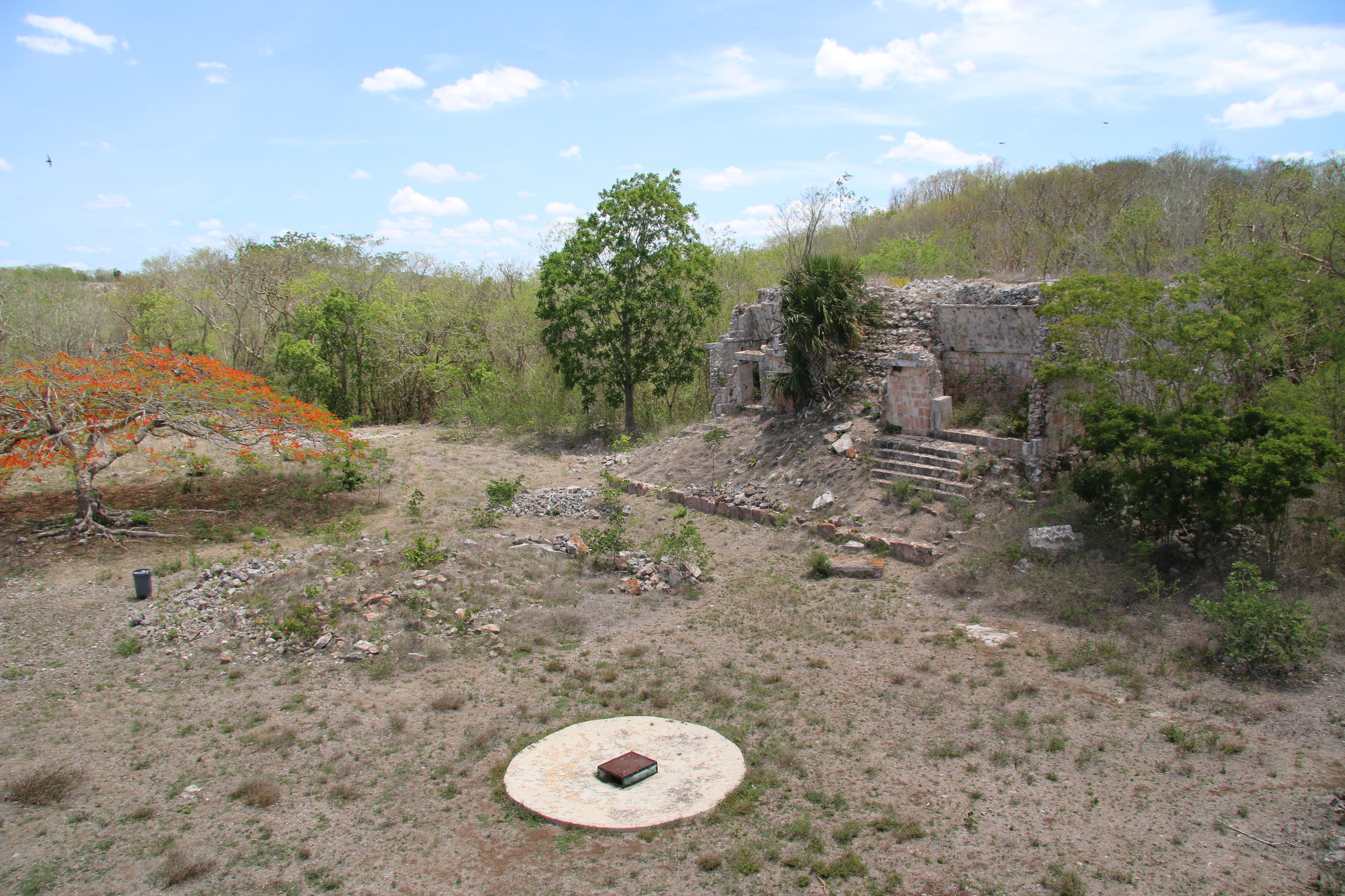
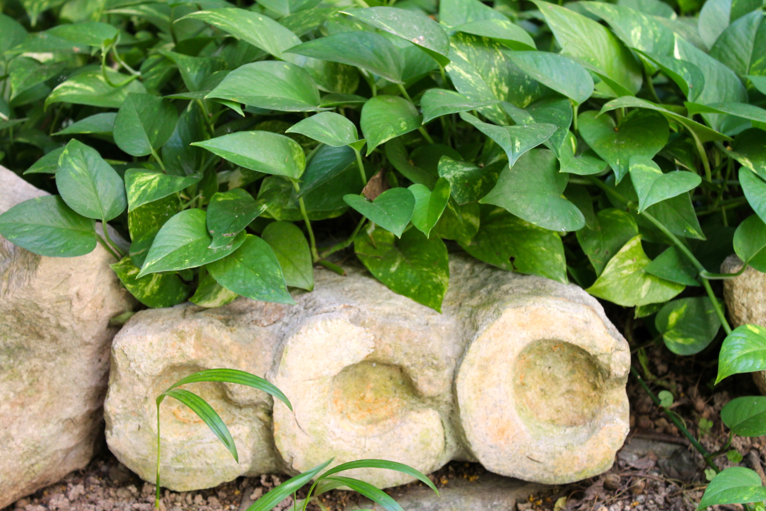
That round abomination in the photo is the INAH “restoration” of a chultun.
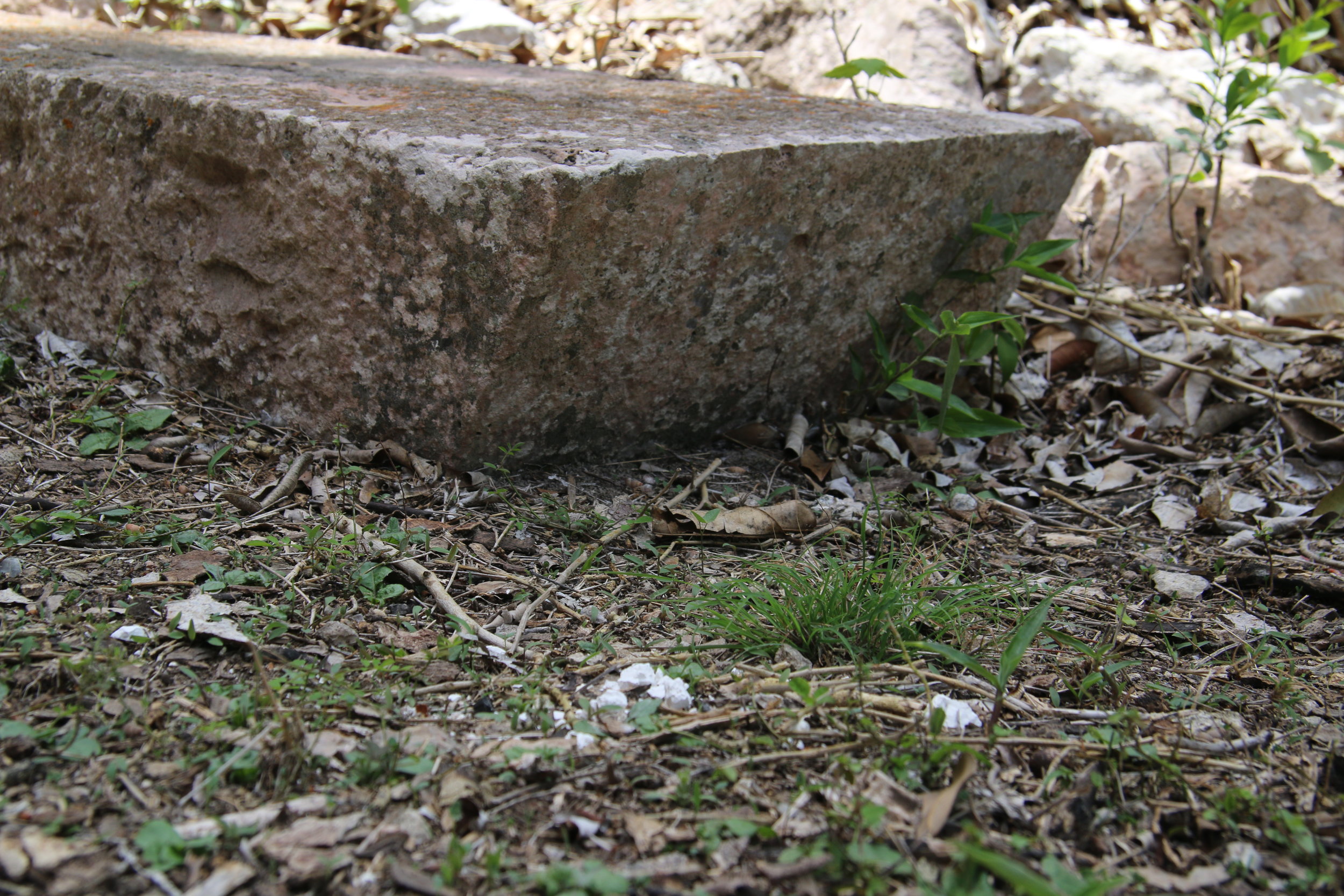
One of the characteristics of the Puuc construction is the precision of the stone cutting. Note the perfect sharp angle cut on this stone.
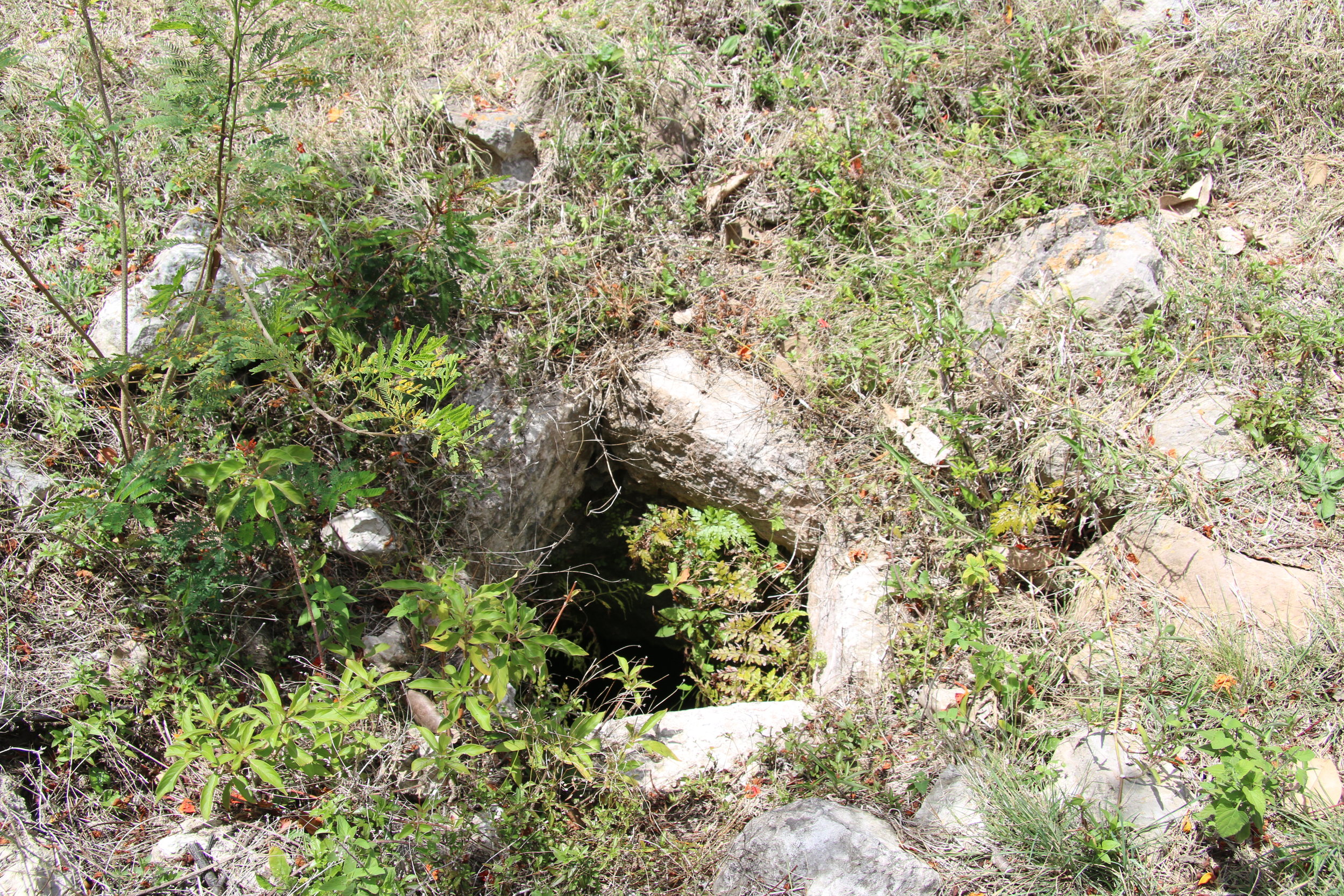
A chultun, one of many
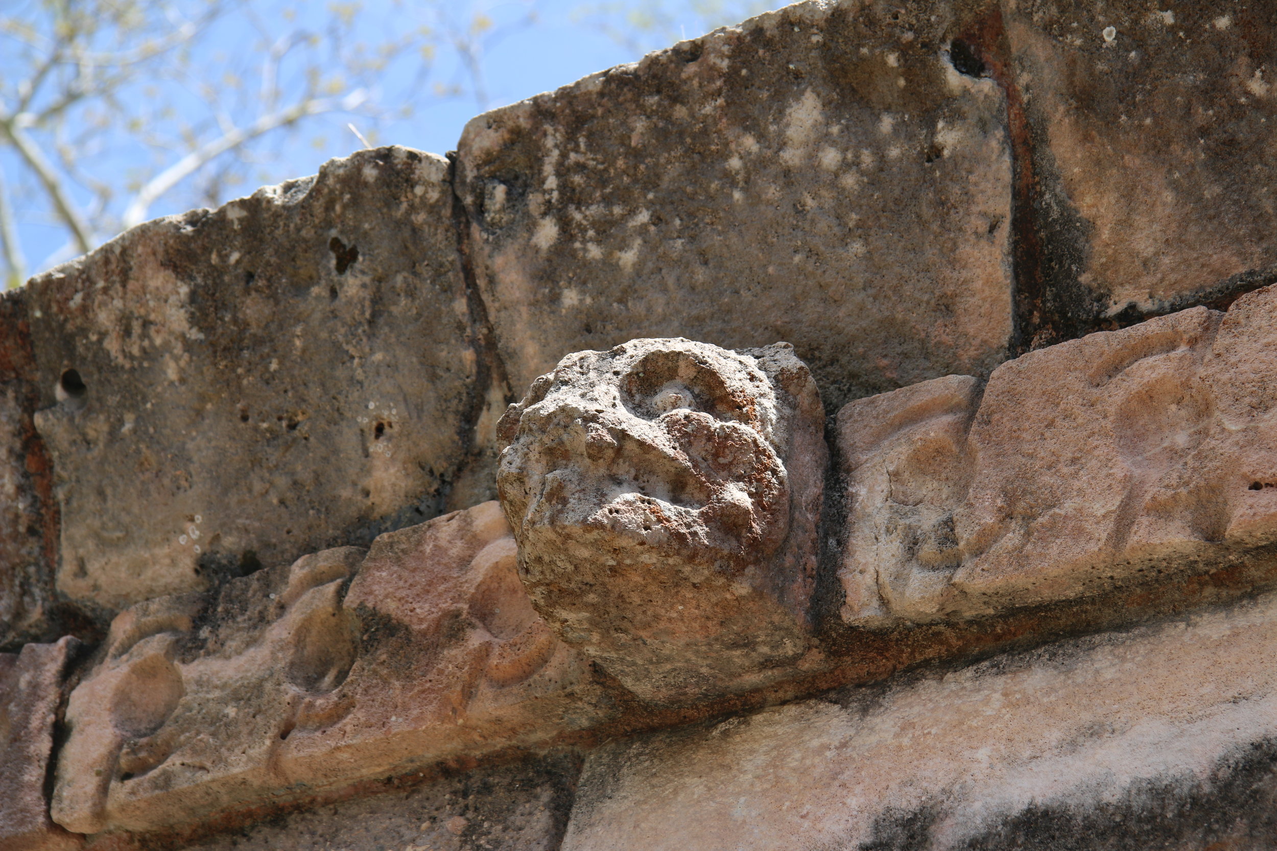
A jaguar head in stone

The obligatory ball court
Stunning
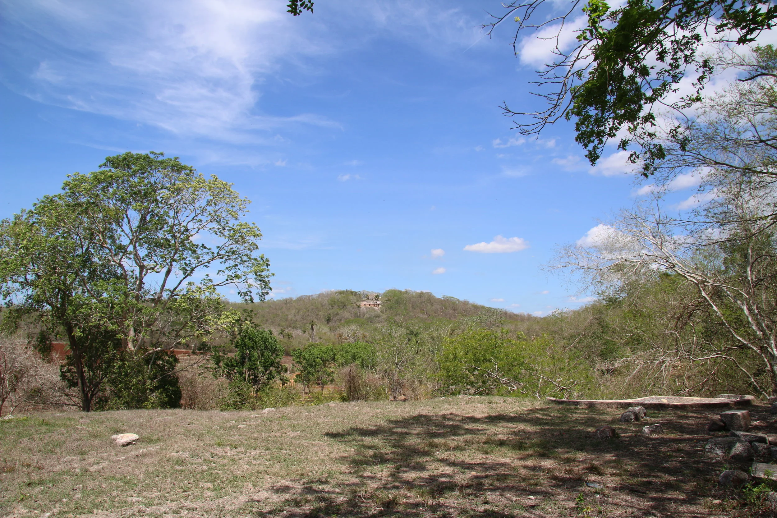
Way off in the distance you can see another part of the site. You will walk there and climb up.
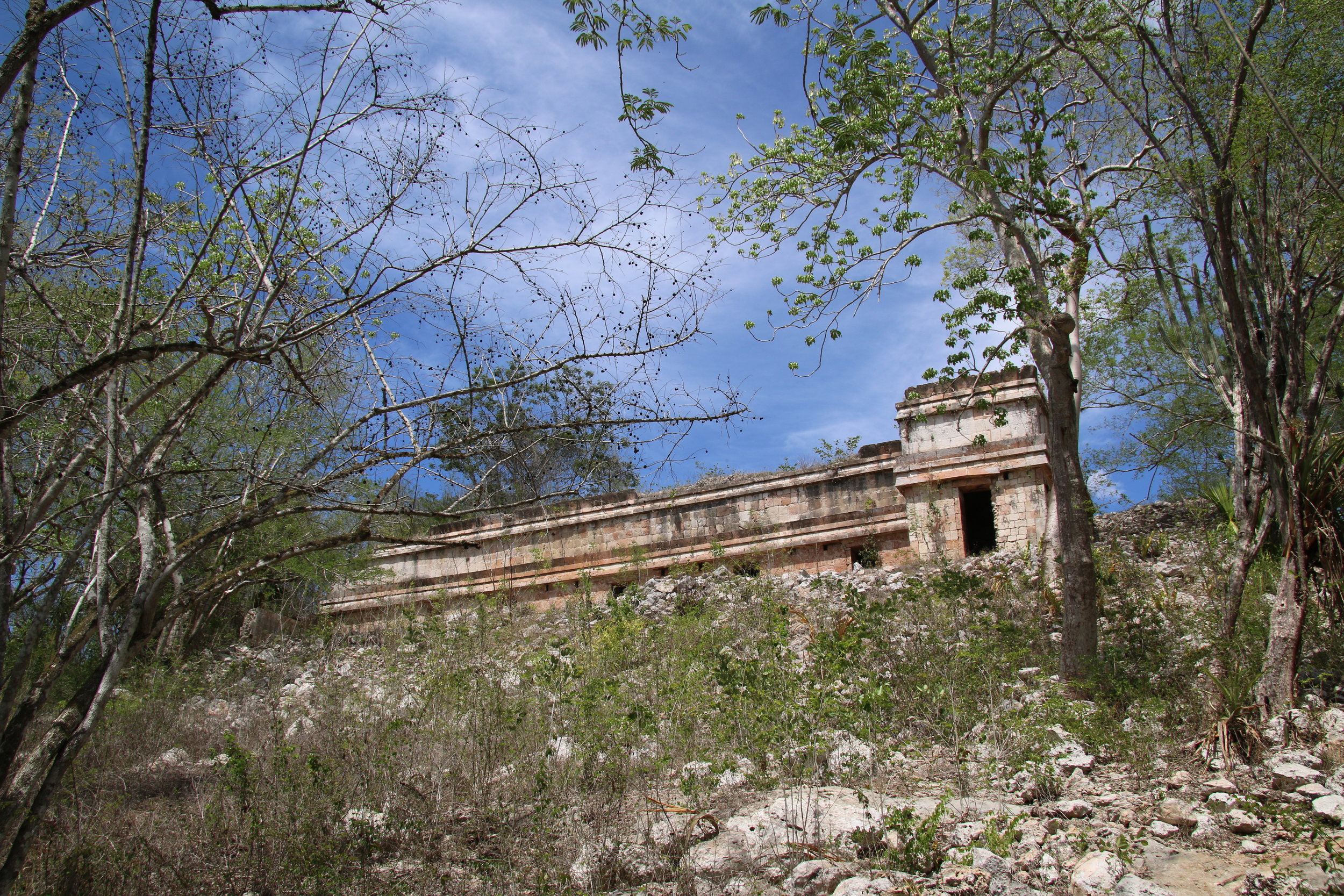
Your climb will reward you with this view
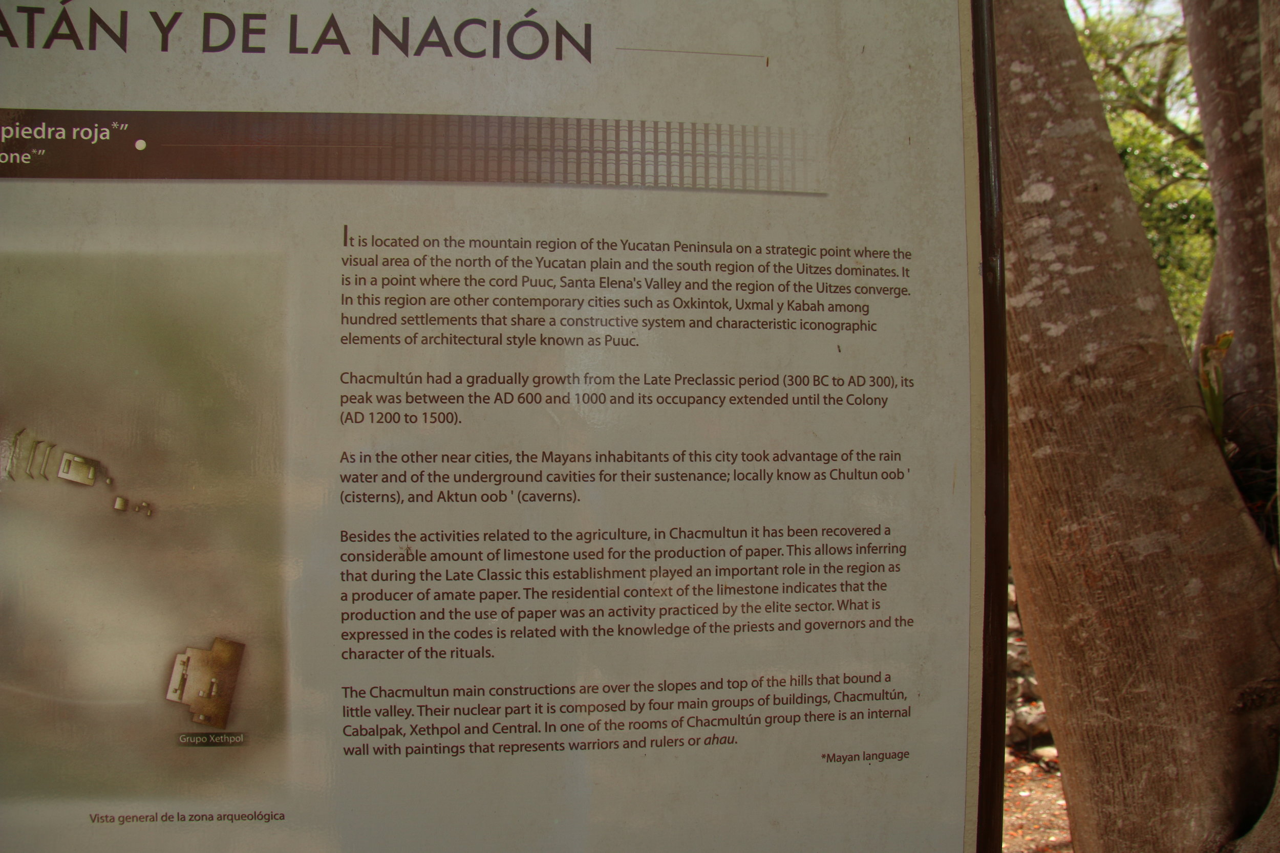
The absolutely unforgivable and horrendous English text
The day started with a stop at Uman, which is nowhere near the so-called convent route, but since we were going to Ticul and Mani and had been the other way before, I thought the Uman-Muna route would provide some interesting views along the way. The large small town, our first stop, is where there is a giant church as well as all those insect-like mototaxis buzzing about.
Done with Uman and ready for more driving, we continued on to Muna. No church pictures there, but a huge procession/demonstration to do with Earth Day perhaps judging from the signs blocked traffic in Muna's main square while every citizen from the surrounding 17 mile radius marched in the parade. Mostly kids of school age, and in uniform.
There wasn't much to do in the traffic, limited though it was and while waiting I snapped a shot of this beautiful old home, probably once owned by some rich fat cat and now a school.
Finally, we made it to Ticul. There, after checking to see which was the best way to Mani we snapped a few shots of that church (and the surrounding street area) as well.
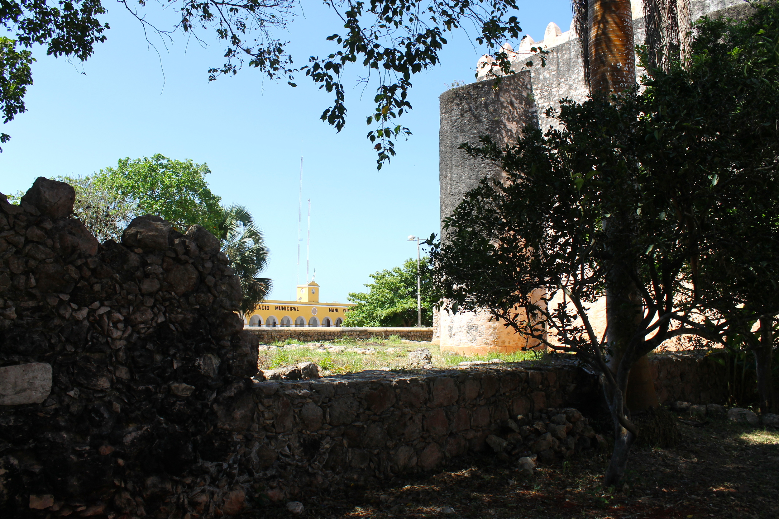
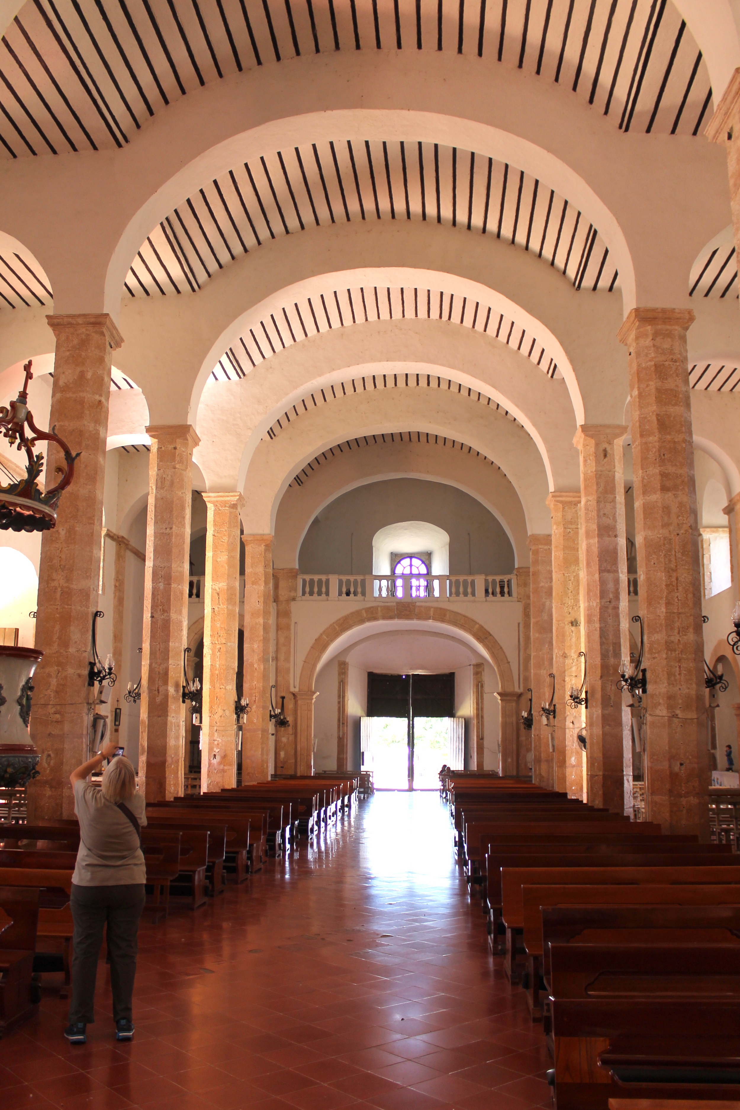
And then, at long last, we made it to Maní, site of the infamous auto da fé, where the charming Friar Diego de Landa, burned as much of an entire culture as one man with a mission can, effectively wiping out the great majority of the Mayans legends, stories and cultural and religious icons. Later, and in his defense when put on trial for overstepping his mandate, he wrote a book about what he had seen and how the Mayans had lived which is now the only record historians have of that time. And to put the proverbial cherry on the sundae, he was absolved of any wrongdoing by the courts in Spain and sent back to the Yucatan and was named "Protector of the Indians". Nice job, Diego.
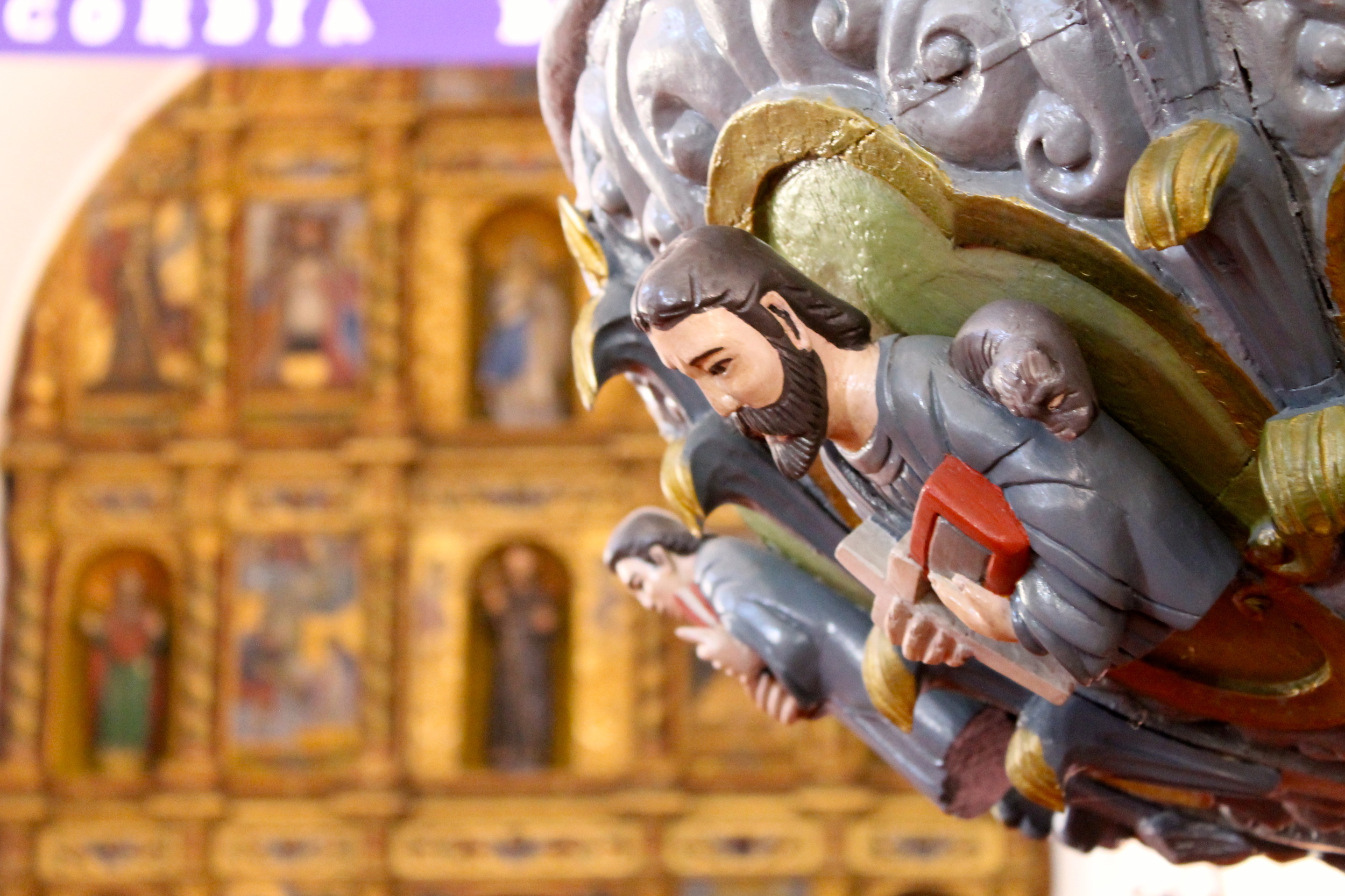
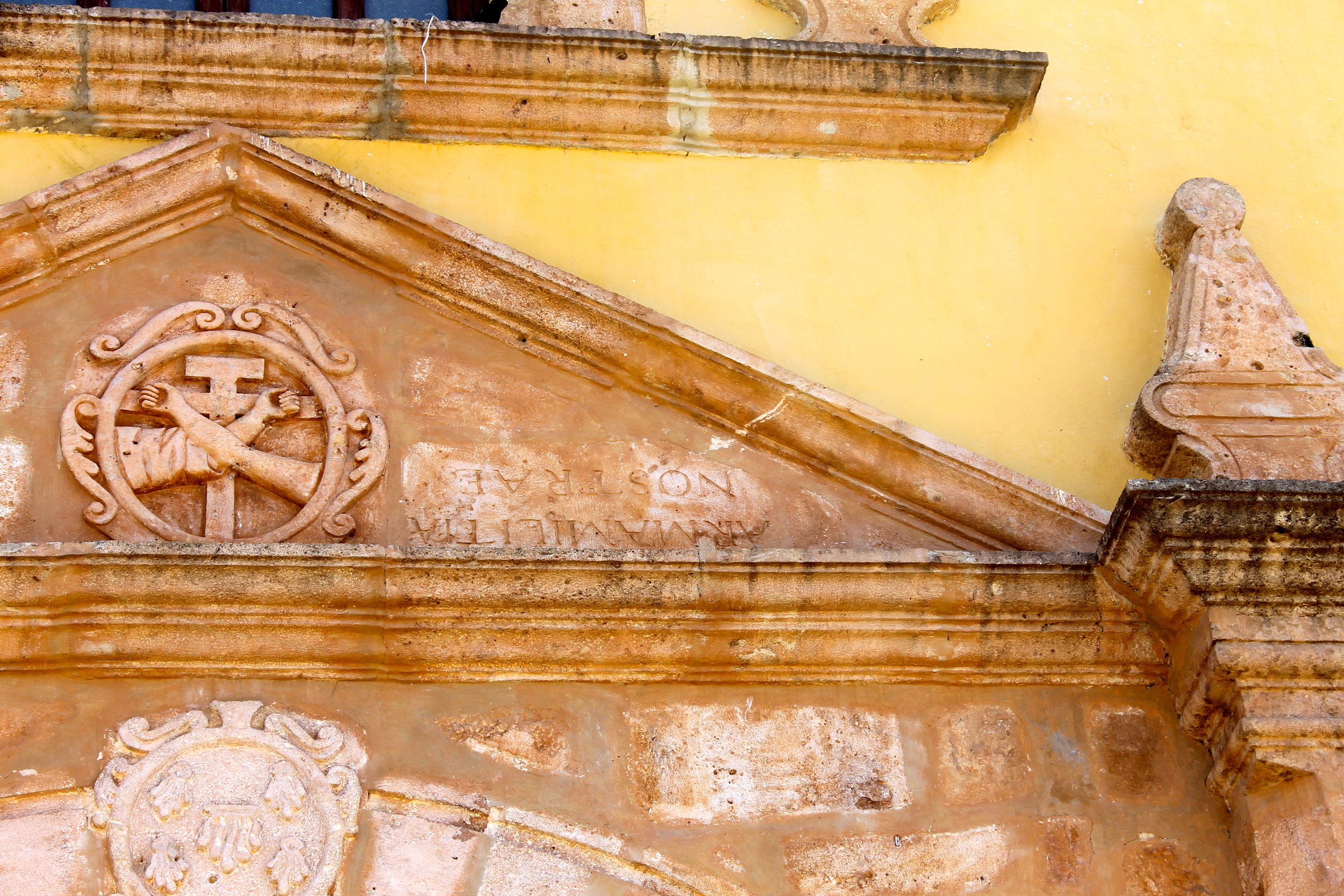
After Maní, what else is there in the world of churches, right? Well, how about the church at Oxcutzcab? This town is famous for it's fruit market and the mural over it, but the church also has it's particular charm.